Okay, I’ve been passively watching, safe in my relative geography. Then today I read that there are TWO Fukushima nuclear plants.
It’s F1 that’s having all the problems, reportedly F2 is shut down and cooling off.
When I’m confused about geography, my current go-to is Google Earth.
So:
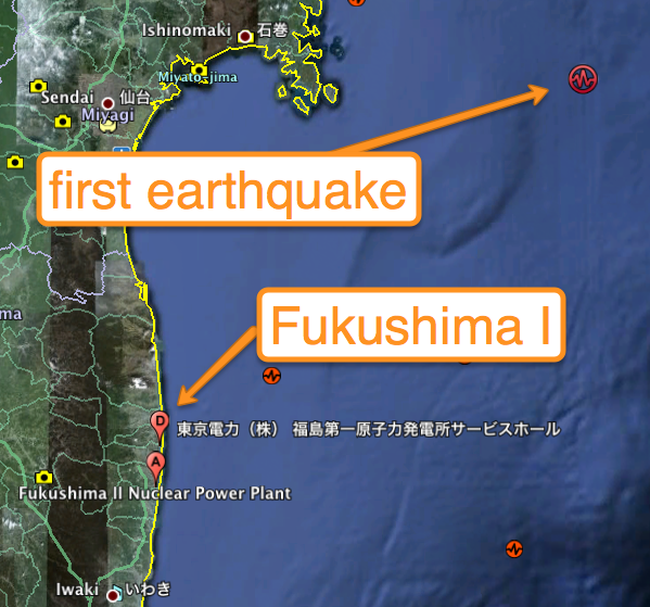
There are two Fukushima nuclear plants, you ask?
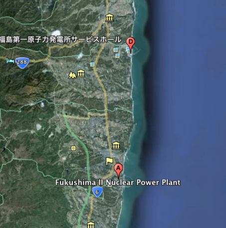
So, what’s F1 look like, from above?
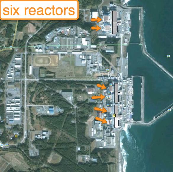
(Update: from Reuters, a nice diagram. Via @scanman).
I have no idea which of the six are in trouble. I’ll leave it to you to tell me which are. Also, reportedly somewhere there are ‘rod ponds’ where the used fuel rods are kept here on site, and it’d be nice to know
Incidentally, it looks to my uneducated eye that the Japanese bury their power lines. US power plants are renowned for their transmission lines stringing in overhead. None here that I can see. (Tell me if I missed it). Probably typhoon-related. Update: Yes, I missed them. They’re there. Thanks to the commenter!
And, F2?
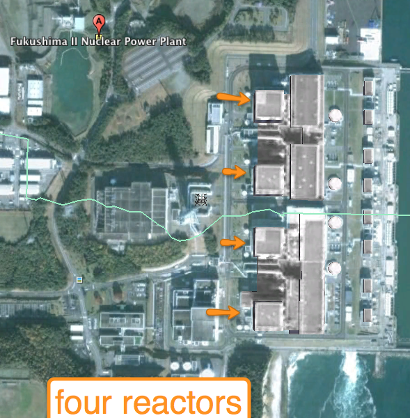
Again, I believe these are okay. I’m not in the know, so YMMV.
And, as these are North of Tokyo (24M people), How Far North are they?
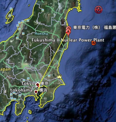
It’s 140 miles. Cozy, unfortunately.
I have nothing to add to the commentary on the nuclear problems there. It’s beyond me in intensity and scope. I can only hope for the best for the operators there, and the rest of Japan.
Interesting times.



The pictures you included seem old so while it would be possible to say which is which ‘number 1, 2 ..’ (f.e. if I remember correctly the top 2 are 5 and 6 the other ones 1-4.
There are however better images available, with exact dates, where the damage is very visible.
http://www.digitalglobe.com/index.php/27/Sample+Imagery+Gallery
Nice images, thanks for the link.
You are confused, I think; my 1&2 mean the plants not the reactors.
Oh right, sorry. Still half-asleep I guess.
One power line (shadow) here: http://goo.gl/maps/ASzL
I agree in that I don’t see many, and don’t exactly see the switch yard. What are the tall tall red and white towers. The numbers seem to vary with the date of the photo.
Martin,
Wow, good eye. Looking in more detail, I see several power towers and lines, so my impression was incorrect, they don’t bury their lines.